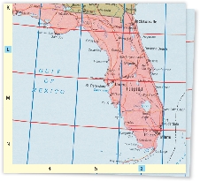
Political Maps
A political map shows the boundaries between countries, states, and other areas. It also shows capitals and other major cities. Road maps are usually set up like political maps.
A grid system is used on these maps to make it easy to find a particular place. Look up the place name in the index to find the right map and a code to the exact location on the map. For example, L-6 for this map is the square at which the row L and the column 6 intersect. Can you find Orlando somewhere in the square?
Globe
A globe is a small model of the Earth. A globe has a round shape like the Earth does. It gives a better picture of Earth than a flat map does.
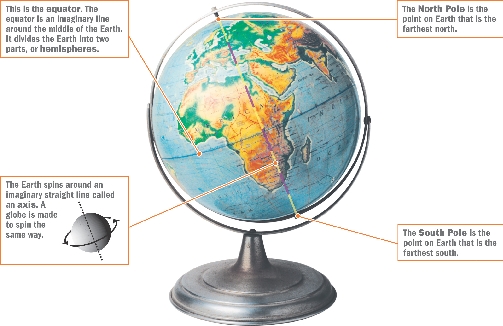
This is the equator. The equator is an imaginary line around the middle of the Earth. It divides the Earth into two parts, or hemispheres.
The North Pole is the point on Earth that is the farthest north.
The Earth spins around an imaginary straight line called an axis. A globe is made to spin the same way. 
The South Pole is the point on Earth that is the farthest south.